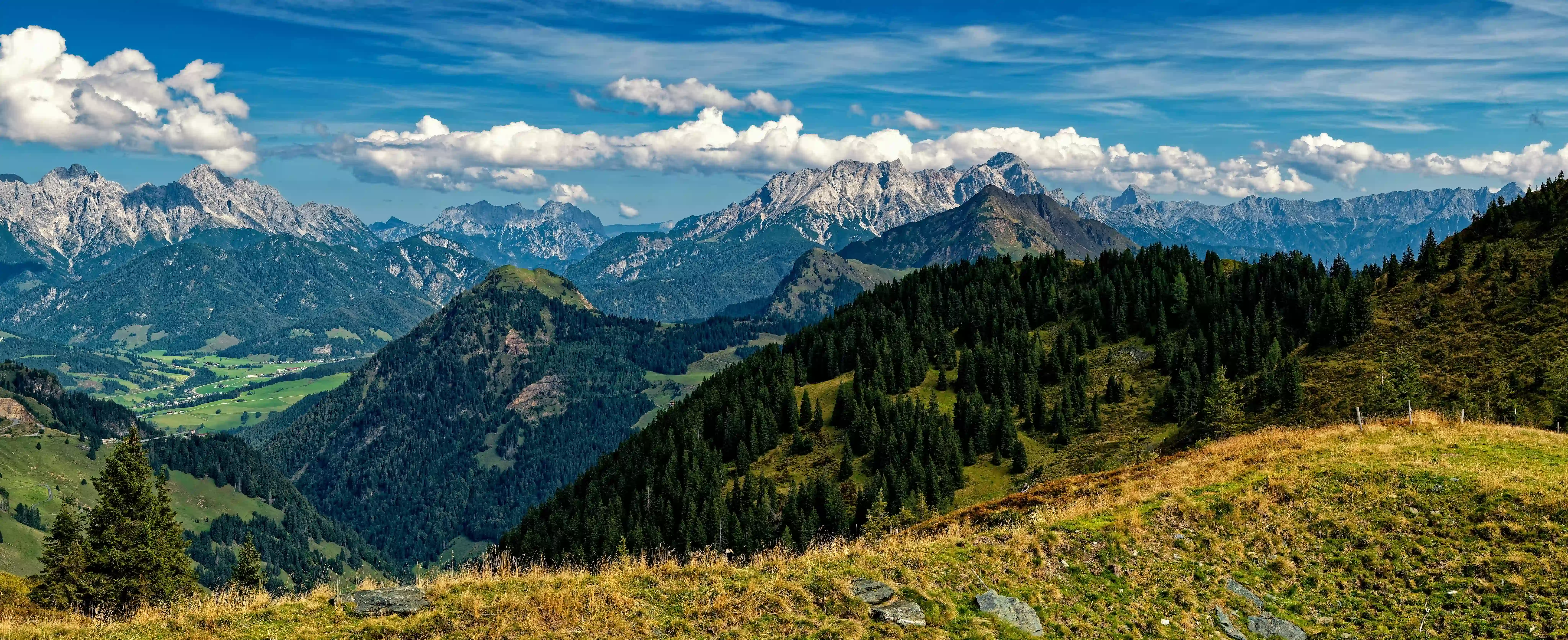
Everyone has seen the photographs. The turquoise crescent of Attabad Lake reflected in a thousand phone screens. The terraced apricot orchards of Karimabad climbing toward Rakaposhi. Skardu's cold desert ringed by peaks that belong to no earthly catalogue. These places are extraordinary — and precisely because of that, they are no longer secret. In peak season, the Karakoram Highway carries traffic jams worthy of Lahore. But Gilgit-Baltistan is vast, and its most extraordinary places sit far from the highway, down unpaved tracks, across swollen rivers on foot bridges, in valleys whose names most Pakistanis have never heard.
This guide is for the curious traveller — the one who wants to arrive somewhere and feel genuinely alone with the mountains. We have compiled seven offbeat destinations in Gilgit-Baltistan for 2026, complete with honest travel costs, how to reach each one, the best season to visit, and what makes each place worth the extra effort.
2026 Travel Note: Always check current road conditions and weather advisories before departing for remote GB destinations. The Karakoram Highway and feeder roads are subject to landslides, flash floods, and seasonal closures — especially after the monsoon season (July–August). We recommend registering your travel plan with local police at Gilgit or Ghizer for high-altitude and border-adjacent areas.
Phander Valley, Ghizer
"The valley that forgot it was supposed to be famous."
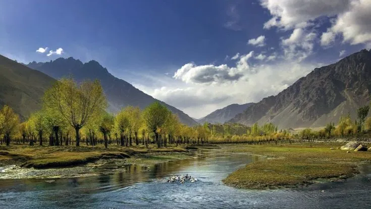
Phander Lake is arguably the most beautiful body of water in Pakistan that most people have never heard of. It sits in the Ghizer Valley — a long, forested corridor that runs west from Gilgit toward Chitral — its surface shifting between emerald and deep sapphire depending on the hour, framed by pine forests and snow-capped ridges. Unlike Attabad, there is no floating restaurant, no boat rental queue, no gift shop pressing against the waterline. There is the lake, the mountains, the sound of the Ghizer River, and occasionally a herd of yaks moving across the far slope.
The surrounding valley — spanning the villages of Phander, Teru, and Gupis — is inhabited by Khowar-speaking communities who have lived alongside these mountains for centuries. Local guesthouses are simple but warm, and the hospitality is exceptional. Trout fishing in the lake is a local tradition; ask your host to arrange it.
Highlights at Phander
- Dawn light on Phander Lake — colours shift from silver to jade before 7 AM
- Trekking the Shandur Plateau (3,734 m) — the world's highest polo ground, 3 hours from Phander
- Village walk through Teru — ancient watermills, wooden mosques, apricot orchards
- Trout fishing in the Ghizer River with local guides
- Stargazing — near-zero light pollution makes the Milky Way visible to the naked eye
Shimshal Village, Upper Hunza
"The village that produces mountaineers the way other villages produce farmers."
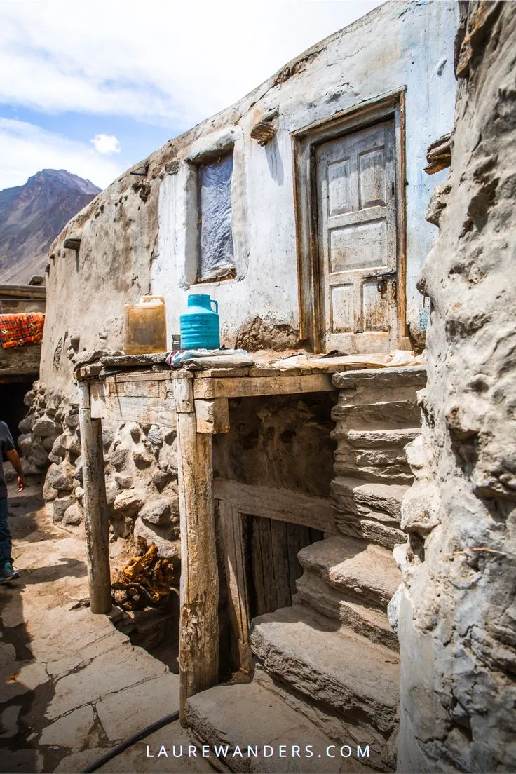
Shimshal is unlike any village in Pakistan. Accessible only by a narrow, jaw-dropping jeep track that was carved from sheer rock faces above the Shimshal River — a road so dramatic it has been featured in international adventure travel documentaries — it sits in a wide, high-altitude valley ringed by four-thousand-metre walls. The Shimshali people are Wakhi, descendants of communities who traded across the Pamir; many of Pakistan's most celebrated high-altitude mountaineers come from this single valley.
Beyond the village, Shimshal Pamir — a vast summer grazing plateau at 4,700 metres — is one of the most dramatic landscapes in all of South Asia. Wild Marco Polo sheep have been spotted here. Yak caravans still make the seasonal crossing. The silence at Shimshal Pamir on a clear day, surrounded by the Karakoram, Hindu Kush, and Pamir ranges simultaneously, is an experience that resists description.
Foreign nationals require an NOC (No Objection Certificate) to visit Shimshal, as it sits near restricted border areas. Apply through your tour operator or the Deputy Commissioner's office in Gilgit at least two weeks in advance.
Highlights at Shimshal
- The jeep track itself — one of the most dramatic mountain drives on earth
- Shimshal Pamir at 4,700 m — yaks, wild sheep, and unbroken 360° mountain horizons
- Homestay with a Shimshali mountaineering family — stories of K2 and beyond
- The Mingling Glacier viewpoint trek (5–6 hours return)
- Wakhi cultural evening — music, butter tea, dried mulberries, and flat bread on an open fire
Batura Glacier, Gojal
"The seventh-longest glacier outside the polar regions — and almost nobody visits it."
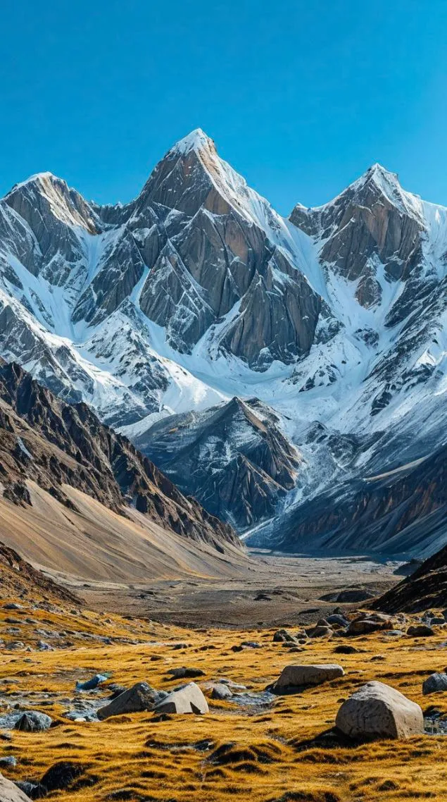
Most visitors to Passu spend their time at the famous Passu Cones viewpoint and the suspended Hussaini Bridge — both extraordinary, both heavily photographed. Fewer walk the hour-long trail to the snout of the Batura Glacier, which at 57 kilometres in length is one of the longest glaciers outside the polar ice caps. The glacier's surface is a lunar landscape of seracs, crevasses, and ridges of moraine, with the Batura Muztagh range soaring above it. Walking on the lower reaches with a local guide is an otherworldly experience available to any fit traveller.
The Batura Glacier trek — a multi-day route following the glacier's lateral moraine through shepherd settlements to high camps — is one of the great underpublicised treks in Pakistan. Done properly over 5–7 days, it offers sustained views of Batura I (7,795 m) and Batura II alongside complete solitude.
Highlights at Batura
- Standing at the glacier snout — close enough to feel the cold radiating from the ice wall
- Multi-day Batura Glacier Trek — Camp 1 through Camp 3 with views of Batura I
- Passu Cones at golden hour — the classic view, best seen away from the midday crowds
- Crossing the Hussaini Suspension Bridge — one of the world's most dramatic walkways
- Visiting the Gojal Heritage Museum in Gulmit — Wakhi history and Silk Road artefacts
Naltar Valley, Gilgit
"Three rainbow-coloured lakes hidden at the end of a pine-scented valley."
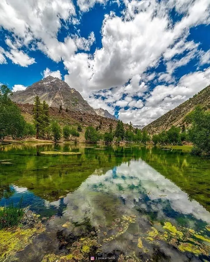
Naltar Valley is the kind of place where people arrive for a day and stay a week. It sits roughly 40 kilometres north of Gilgit city, reached by a military road that climbs through dense pine forests of spruce and fir — a rarity in this otherwise barren mountain region. The valley is home to Pakistan's only ski resort, used primarily by military and elite athletes for winter training. But the summer spectacle is the real draw: three high-altitude lakes — Naltar Lake (Blue), Upper Naltar Lake (Green), and Lower Naltar Lake — each reflecting different mineral compositions in the bedrock below, giving each a distinct, jewel-like colour.
Beyond the lakes, Naltar is a gateway for serious trekkers heading toward the Naltar Pass and onward to Ishkoman. The pine forests themselves are extraordinary for birdwatching — this is one of the few places in northern Pakistan where the Western Tragopan pheasant has been recorded.
Highlights at Naltar
- The three coloured lakes at 3,700 m — blue, green, and teal in one panoramic view
- Dense pine forest walking trails — cool, fragrant, and unlike anywhere else in GB
- Birdwatching — snow leopard territory; Himalayan Snowcock and Chukar partridge common
- Winter skiing (December–February) — basic slopes but genuine mountain powder
- Naltar Pass trek (advanced) — connects to Ishkoman Valley over 4,600 m
Chapursan Valley, Gojal
"Where the road ends, Afghanistan begins, and the world grows very quiet."
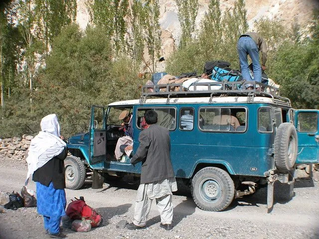
The Chapursan Valley is the last inhabited valley before Afghanistan — and it feels like it. The road from Sost climbs steadily westward along the Chapursan River, past a chain of small Wakhi villages (Zood Khun, Raminj, Yarzirich, Reshit) whose mud-and-stone architecture seems grown from the mountain rather than built upon it. At the valley's head, the Irshad and Chillinji passes lead toward the Wakhan Corridor. Koz Sar (6,677 m) dominates the horizon. Marco Polo travelled these routes in the 13th century — and the landscape has changed very little.
Chapursan offers something increasingly rare in the modern world: genuine edge-of-the-map solitude. The communities are small, deeply hospitable, and largely dependent on subsistence farming and seasonal herding. Tourism here is new enough that your presence as a visitor still occasions genuine curiosity rather than commercial transaction.
Highlights at Chapursan
- Wakhi homestays — traditional stone houses, yak butter tea, home-baked bread, storytelling
- Irshad Usht base camp trek — views to the Afghan Wakhan, 5,600 m
- Birdlife — Bar-headed geese, Lammergeier vultures, Golden Eagles common
- Ancient petroglyphs along the valley floor — ibex and human figures carved by Silk Road travellers
- Eid and harvest festivals (seasonal) — among the most authentic in GB
Minimerg, Astore Valley
"Nanga Parbat's backyard — green, wild, and free of the crowds at Fairy Meadows."
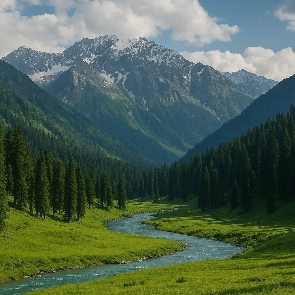
Fairy Meadows — the famous base camp below Nanga Parbat's Rakhiot Face — has become one of Pakistan's most crowded trekking destinations. But Astore Valley, which approaches Nanga Parbat from the south, remains quietly, stubbornly undervisited. Its principal gem is Minimerg: a wide, flat alpine meadow at the head of the valley, carpeted in wildflowers from May through September, ringed by ridges that rise toward Nanga Parbat's Rupal Face — the highest mountain face on Earth at 4,600 metres of vertical relief.
The Rupal Face from Minimerg is a view that regularly moves trekkers to tears. It is simply one of the most overwhelming natural spectacles in the world, seen by relatively few people. From Minimerg, the Rupal Valley trek leads through increasingly dramatic terrain toward Shaigiri and the Mazeno Pass — a serious high-altitude route for experienced mountain travellers.
Highlights at Minimerg
- Nanga Parbat's Rupal Face — the highest mountain face on Earth, seen at close range
- Wildflower meadows in June–July — gentians, edelweiss, and primulas carpet the valley floor
- Herp Lake trek (5–6 hours) — a glacial lake at 4,200 m with crystalline clarity
- Camping under Nanga Parbat — wake up at 4 AM for alpenglow on the summit pyramid
- Astore bazaar — traditional Shina culture, local crafts, and warm mountain hospitality
Darkot Pass, Ghizer
"An ancient Silk Road crossing at 4,900 metres — walked by Alexander's soldiers, forgotten by modern travellers."
Of all the destinations in this guide, Darkot Pass demands the most from its visitors — and rewards them most richly. The pass at 4,900 metres connects the Yarkhun Valley of Chitral with the Ghizer district of Gilgit-Baltistan, crossing the Hindu Kush along a route that was used by traders, armies, and nomads for centuries before the Karakoram Highway made mountain crossings obsolete. It is one of the great wilderness treks in Asia, rarely done, almost entirely without infrastructure, and absolutely spectacular.
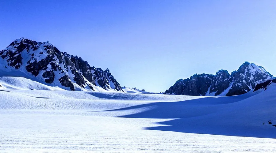
The approach from the Ghizer side follows the Darkot River through increasingly dramatic terrain — towering granite walls, hanging glaciers, alpine meadows used as summer pasture. The pass itself requires crampons and ice axe experience in all but the driest late-August conditions. On the far side, the descent into Yarkhun is a landscape of such severity and beauty that experienced trekkers consistently rate it among the defining experiences of their lives.
Experienced trekkers only. Darkot Pass requires glacier travel skills, physical fitness, and a licensed local guide. Never attempt this trek without an experienced guide and porter team familiar with the specific conditions of that season.
Highlights — Darkot Pass Trek
- The pass at 4,900 m — Hindu Kush, Karakoram, and Hindu Raj ranges visible simultaneously
- Darkot Glacier crossing — technical glacier travel with a guide
- Summer shepherd settlements along the approach — Gujjar and Kohistani herding culture
- Complete wilderness — no villages, no phone signal, no other trekkers for days at a stretch
- Completing a 700-year-old trade route — a profound sense of historical connection
Best Time to Visit — Season by Season
Gilgit-Baltistan has a high-altitude continental climate — short, intense summers and long, bitter winters. The right season varies by destination, but here is a general guide:
What to Pack for Offbeat GB
Remote valleys do not have Amazon delivery. Bring everything you need:
The places that are hardest to reach are almost always the ones that leave the deepest marks. In Gilgit-Baltistan, the difficulty is not the price of admission — it is part of the experience itself.
— Murree Heights Travel TeamPro Tips for Offbeat GB Travel in 2026
- Hire local guides always — they know road conditions, weather signs, and open guesthouses. This is not optional in remote areas.
- Learn 10 words of Shina, Wakhi, or Burushaski — the warmth this unlocks in remote communities is worth more than any guidebook.
- Carry small denomination PKR notes — villages cannot break a Rs.5000 note, and ATMs are hours away.
- Respect seasonal rhythms — some passes are safe only in a 3–4 week window each year. A local guide knows exactly when.
- Leave nothing behind — these communities are beginning to deal with plastic waste. Pack out everything you pack in.
- Accept hospitality generously — refusing a cup of tea is a genuine slight in Wakhi culture. Accepting it is one of the great small pleasures of mountain travel.